Pont d'Aël Roman Aqueduct
Położenie pokaż na mapie
Aymavilles
- Kategoria: bridges-aqueducts
- Sekcja: Ancient Bridges - Aqueducts
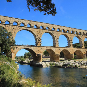
The Pont d'Aël is a Roman aqueduct bridge in the village of the same name, in the comune of Aymavilles, in Aosta Valley, Italy. The bridge, constructed in 3 BC, carried water for the agricultural lands of the newly founded colony Augusta Prætoria Salassorum (today: Aosta) across a side valley, 66 m above the bottom. It belonged to a sophisticated, 6 km long aqueduct, running along the steep cliffs of the valley. The originally three-story structure featured a roofed control corridor; notably, it was privately financed. Today, the Pont d'Aël carries a hiking trail.
Besides the Pont d'Aël, two other Roman bridges in the Aosta valley are still intact: the Pont-Saint-Martin in the town of the same name and the Pont de Pierre in Aosta.
Besides the Pont d'Aël, two other Roman bridges in the Aosta valley are still intact: the Pont-Saint-Martin in the town of the same name and the Pont de Pierre in Aosta.


Położenie na mapie / Jak tam dojechać
Znajdź nocleg w pobliżu (Wyszukianie noclegów w pobliżu tej budowli jest obsługiwane przez Booking.com)
Pogoda w okolicy
Dzisiaj (19 kwietnia)

6.7 ° C
-4.1 ° (min) 7.6 ° (max)
0 mm
4.8 m/s
1016 hPa
Jutro (20 kwietnia)
4.5 ° C
-3.5 ° (min) 5.5 ° (max)
0 mm
3.9 m/s
1014 hPa
Opinie o Pont d'Aël Roman Aqueduct Dodaj komentarz
Bądź pierwszym, który doda opinię!