Piercebridge Roman Bridge
Położenie pokaż na mapie
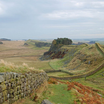
Piercebridge
- Kategoria: bridges
- Sekcja: Bridges - Misc Ancient
Piercebridge Roman Bridge was a Roman bridge, now ruined, over the River Tees, near the village of Piercebridge, County Durham, England.
The bridge was the crossing point over the river Tees for the Roman Road Dere Street. Piercebridge was also the site of a Roman fort.
The Tees has narrowed and changed its course over the centuries so the remains lie in a field around 90 metres (300 ft) south of the current course of the river, and approximately 450 metres (1,480 ft) east of Piercebridge.
What remains of the bridge are the massive masonry blocks that formed the piers of the bridge. The lower courses of one of the abutments still stand, partially complete, and it is possible to see the holes into which the wooden structure of the bridge would have fitted. All of the timber has disappeared in the nearly 16 centuries since the end of the Roman occupation.


Położenie na mapie / Jak tam dojechać
Znajdź nocleg w pobliżu (Wyszukianie noclegów w pobliżu tej budowli jest obsługiwane przez Booking.com)
Pogoda w okolicy
Dzisiaj (23 kwietnia)

8.7 ° C
4 ° (min) 10.2 ° (max)
0 mm
7.2 m/s
1022 hPa
Jutro (24 kwietnia)
7.2 ° C
2.4 ° (min) 9.8 ° (max)
0 mm
6.3 m/s
1018 hPa
Opinie o Piercebridge Roman Bridge Dodaj komentarz
Bądź pierwszym, który doda opinię!